STATE 21: NEVADA
[PLEASE BE PATIENT AS HI-RES IMAGES LOAD]


After spending plenty of time zig-zagging our way up the entire state of California through Joshua Tree National Park, Palm Springs, San Diego, Los Angeles, Big Sur (PART I), Sequoia National Park, Yosemite National Park, Napa Valley, San Francisco, and finally through the Redwoods (PART II), we finally made it to another state.
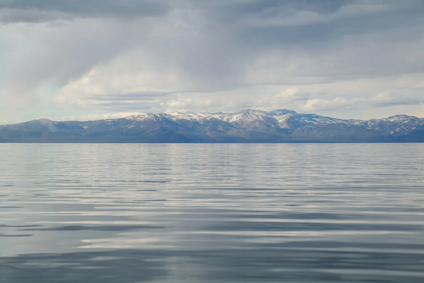
We spent a few days in the early Spring circling and exploring Lake Tahoe, the largest alpine lake (at 6,225ft. above sea level) in the country - but not quite larger than our beloved Great Lakes in volume.
Yet, we couldn’t get over the fact that although the Great Lakes may rival the clear waters, the Mitten State does not compete with the mountains of the Sierra Nevada range that surrounds the cobalt blue lake and endless evergreens along its shores. They’ve got our home state there. Not to mention, its DEPTH is beyond comprehension…


We did a couple scenic hikes along a western coast bay where we learned just how deep Lake Tahoe is. At 1,645ft. deep, it’s the second deepest lake in the U.S. behind Crater Lake at 1,949ft - at least according to a Wikipedia source (but as you’ll see in the picture, apparently the sign marker thinks otherwise).
Best of all, since it was off-season, we were able to stay just about as close as you could park a trailer to the lake.

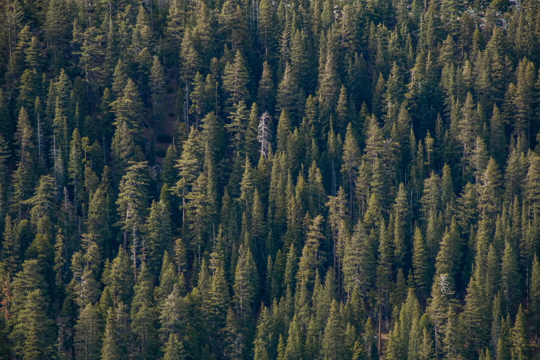
Through the pine needle-covered floor of the skinny forest was the bright blue lake from our campsite at the Campground By The Lake in South Lake Tahoe. I don’t think there could have been a more descriptive name possible.
The park was sparsely filled this time of year, which made it even all the better to take in the local scenery around us.


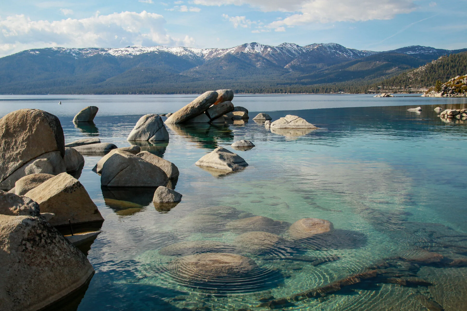
After exploring the western edge of Lake Tahoe the day before, the next afternoon we spent climbing up, down, and around the Nevada side of Lake Tahoe where we were able to see how clear the water is for ourselves — we even went kayaking for a couple hours.
Being early Spring still, the water was still freezing cold. We were instructed to always wear our life jackets because although it was a sunny day that seemed warm above the water, if we were to tip, our bodies would go into shock within moments, making it near impossible to avoid disaster without a floatation device to keep us above water. So, we kept them on to be safe.
You’re welcome, Mom!


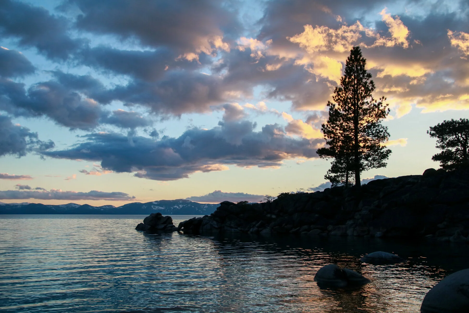
While we were on the eastern shores of the lake, we decided to soak up the sun-filled sunset as it slowing worked its way down below the Sierra Nevada Mountains on the California side.


Being able to inject these few days of R&R had really enabled us to recharge and enjoy the journey as much as possible. Beyond the picturesque hikes and campsite stays, we’re spending hours each day working from the trailer or a nearby coffee shop constantly working on past HERO[series] state projects while also planning ahead.
Much of this juggling can become difficult living on the road with limited Wifi and cell service and even less storage space, so organization has become a MUST for us. It’s been fun to be able to stay organized while also canvasing our trunk with a growing collection of stickers throughout our stops along the way.
If anyone knows someone at Sharpie or Post-It, we’d love to build a brand partnership for the rest of the “50 States: Veterans + Artists United,” so feel free to Contact Us when you’ve got a minute or two. Thanks :)


We had a great STATE 21: NV project in Reno working with artist Kelly Wallis and U.S. Army veteran Bob Goodman. On our second day of the project, they took us to lunch and a walk in the Dickinson area of town that was more our style than the Vegas-like strip of casinos, clubs, and steak restaurants.
Although the vintage signs and lights are a sight to see in downtown Reno, the hand-painted signs and artist studios in Dickinson were the local touch we always look for in each place we visit.


Now, this is where things get a little confusing and need some explaining. After finishing our Nevada project, we headed up to Oregon and continued on our way. We kept going on the tour all the way through to STATE 36: MS until our funding ran dry and we had to indefinitely pause the tour. After the New Year in 2019, we drove from the South back home to Michigan to regroup until we could raise the support needed to finish the tour.
That didn’t end up happening as well or as easy as we thought it would. So while we were doing what we could to raise support, we took some odd-jobs to pay our personal bills. This led us to Walla Walla, Washington during the early Summer of 2019 so Kendra could work with my cousin’s wedding floral business, Kasey D Weddings.
After spending nearly two months working in Walla Walla, Kendra’s parents were flying from Michigan to Las Vegas for her dad’s mattress company’s convention. Although we didn’t have our Airstream with us in Washington at this point, we opted to roadtrip from southeast Washington down to Nevada to meet-up with her parents in the desert.
We packed up a rental car and drove over 924 miles with Noel, litter box and all.


Driving down the center of the state of Nevada gave me the excuse/ability to visit the infamous Area 51, or what little there is to actually see. We were there mere weeks before “The Raid” was supposedly going to take place after a Facebook joke went viral.
There wasn’t much to see or do when we there, nor apparently when the “Storm Area 51” event was supposed to take place. Yet, it was still worth it for me to drive through the desolate Mojave Desert.


We successfully made it to Las Vegas to visit Kendra’s parents. It was actually my first time in Vegas, and to be honest, I wouldn’t mind if it was my last. It’s just not our scene. I really didn’t even take pictures in Vegas. Blah.
Instead we opted to wake up at 4AM, when some people were still stumbling back to their hotels, and drove two hours to Death Valley National Park to catch the sunrise - and more.


We purposefully woke up early to take the Artist’s Drive to see the Artist’s Palette, an area on the western face of the Black Mountains known for its vibrant variety of rock colors that are best seen before the sun hits them.
Their ancient colors are the result of oxidation and decomposition. According to Wikipedia, the iron metal compounds produced red, pink, and yellow colors while decomposition of volcanic ash produces the green hue while manganese produces that pastel purple color that reminds me of French macaroons.
Who knew science and nature could be such a beautiful combination?


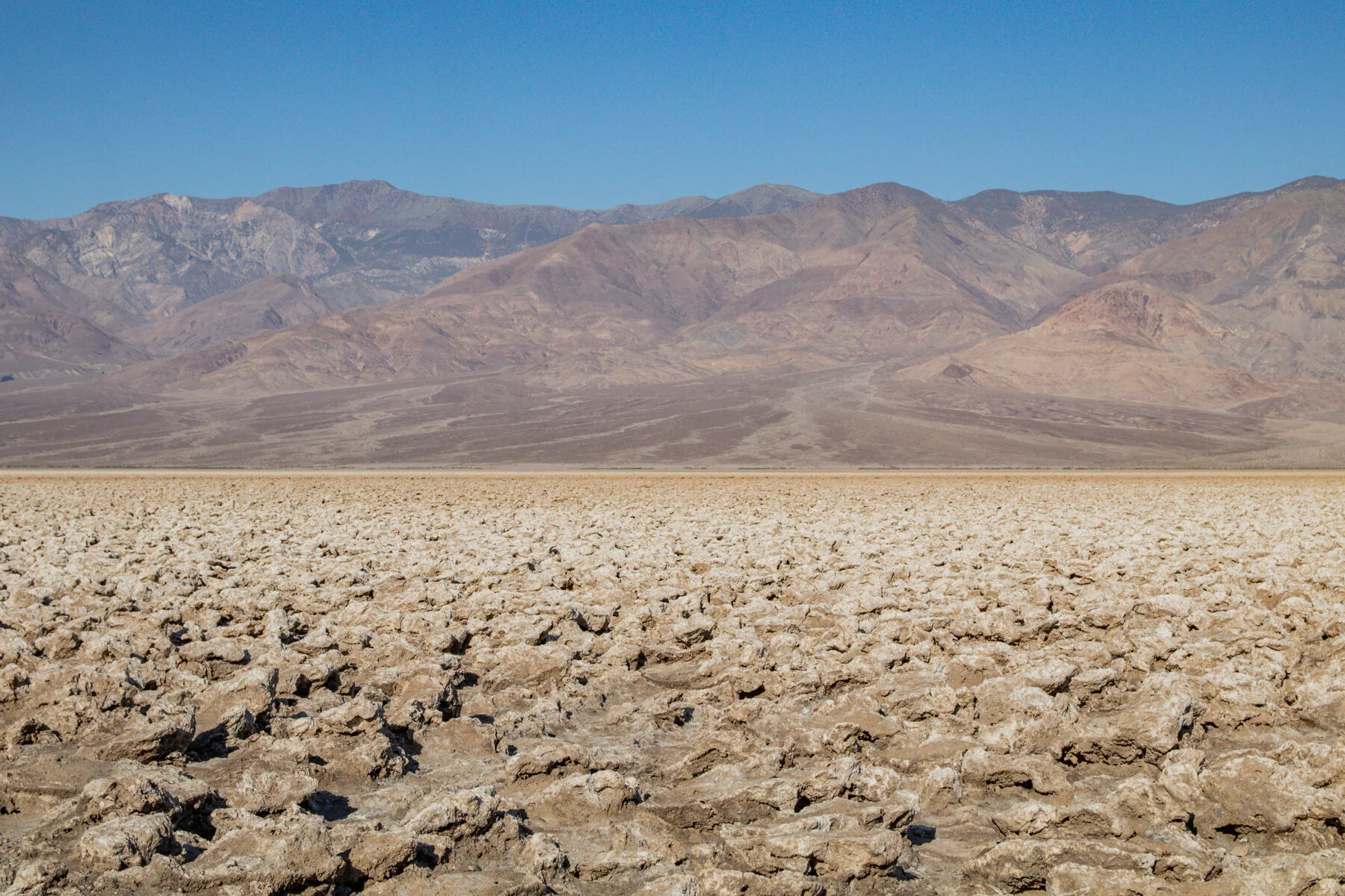
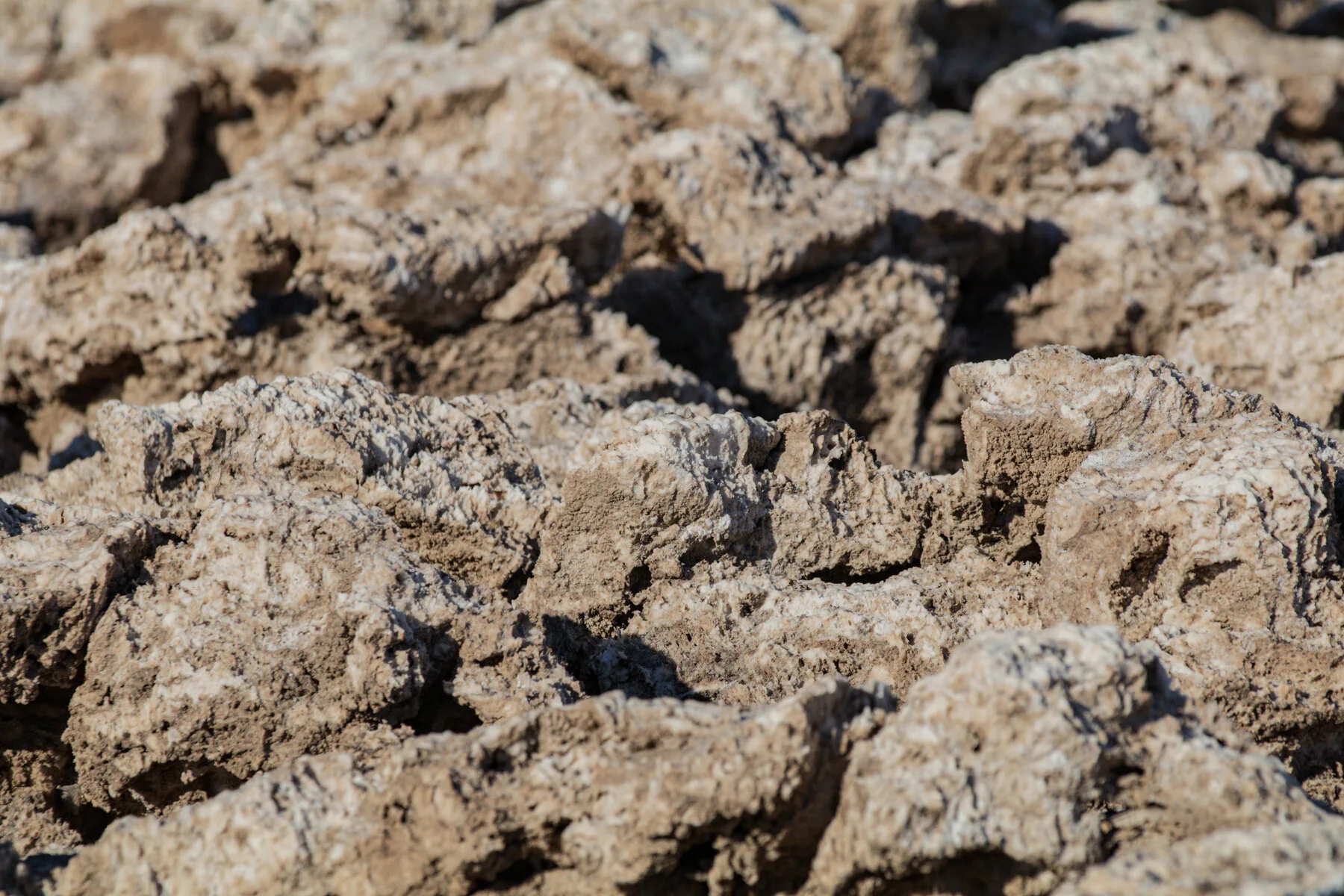
We finished exploring Artist’s Palette just as the sun was peeking over the peaks of the Black Mountains. We then continued deeper into Death Valley down a rustic dirt road into the middle of the valley to the Devil’s Golf Course.
Its name was deprived in 1934 from the visual imagination that “Only the devil could play golf” on the surface of these large halite salt crystal formations that you can hear bubble beneath you in the soaring heat in the middle of the valley floor.
It was intense and surreal, even at 8AM before the day’s heat of well over 100 degrees reached us. Needless to say, we didn’t stay long.


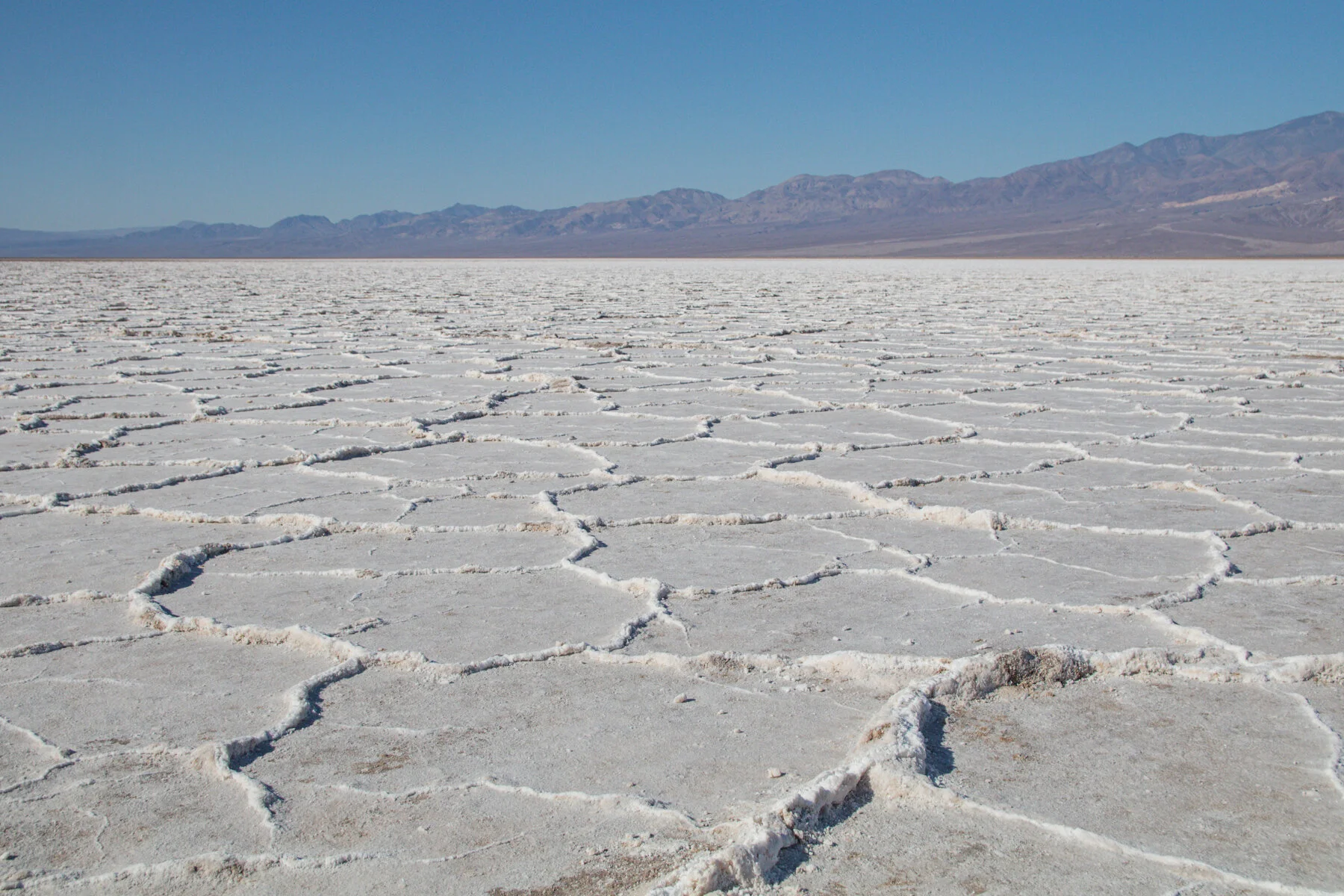
Not long after entering Death Valley, we reached sea level. Then we reached Badwater Basin at just about 282ft. BELOW sea level, the lowest place in the United States — and the hottest. There’s even a STOP sign as you walk off the wooden path that warns you of the deadly consequences of walking out onto the salt flats anytime after 10AM.
Amazingly, there was just a little water left in the shadows from a recent rain storm, but it likely won’t last long with an a 150-inch annual evaporation rate, which is also the greatest rate throughout the U.S.


We were pushing it a little after 9AM as temperatures were already approaching 100 degrees. We walked nearly a mile into the valley where it became harder and harder to breath as our mouths got drier and drier. I’ve never eaten cotton balls like Buddy the Elf, but I’d imagine a mouth of cotton balls wouldn’t have been as difficult as this was... and we were out there for less than an hour.
Supposedly, the salt deposits on this 2000-3000 year old dried up lake bed is made up of what would be considered pure table salt, but I’ll take someone else’s word for it — I wasn’t willing to have a taste for myself. Not without a glass of ice water to wash it down with, at least.


As beautiful as the salt flats were 282ft. below sea level, they were even more beautiful 5,500ft. above sea level from Dante’s View. The weather was also much more tolerable up there as it was 20-30 degrees cooler at a more reasonable 80 degrees.


Amazingly, just 80 miles directly west over a couple sets of mountain ranges is Sequoia National Park, home to the oldest and largest trees in the world. Seeing that on a map is mind-blowing.
But just like that, we left Death Valley before 11AM while our tires weren’t yet melted on the pavement and we still had a few drops of water in our cateens. Thank you Nevada for letting us get out out alive.
Until next time.